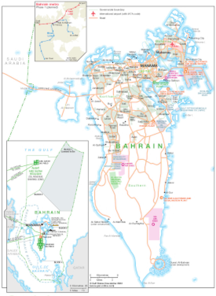
Revised January 2022, this map illustrates Bahrain's major infrastructure. The main map shows governorate boundaries, urban areas, major roads and airport and airbases and the location of power generation plants.
A small inset shows Bahrain's proposed metro routes, while a larger inset provides an overview of onshore and offshore oil and gas blocks- with fields marked alongside associated infrastructure (pipelines, refineries, oil tanker terminals and LNG facilities).
The map is available as a PDF file using eps graphics, meaning that there is no loss of resolution as the file is enlarged.
Single GSN map
£495
(Single GSN map or graphic)
Subscribe to Gulf States Newsletter
Gulf States Newsletter is a brand of