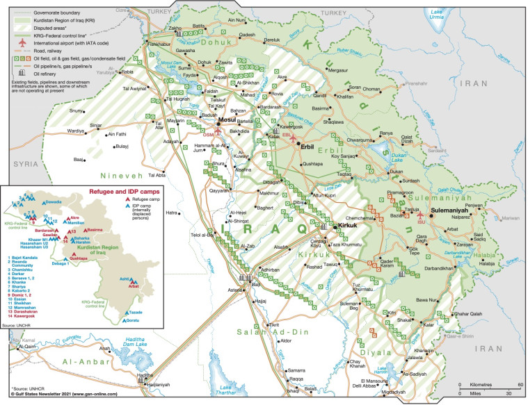
Published in July 2021, this map of the Kurdistan region of Iraq includes it's disputed areas and the KRG-Federal control line. It also shows governorate boundaries, international airports, roads, railways as well as oil and gas fields, oil and gas pipelines, and oil refineries.
There is a box displaying the location of refugee and IDP camps.
The map is available as a PDF file using eps graphics, meaning that there is no loss of resolution as the file is enlarged.
Single GSN map
£495
(Single GSN map or graphic)
Subscribe to Gulf States Newsletter
Gulf States Newsletter is a brand of