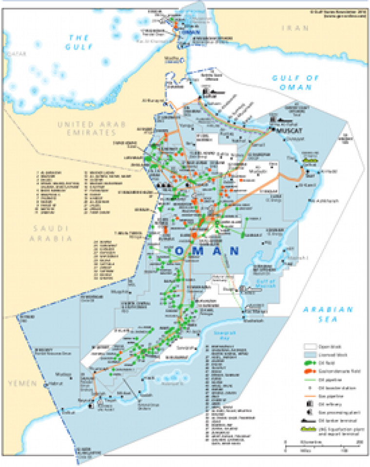
Revised June 2014, this map provides an overview of hydrocarbons infrastructure in Oman. Oil and gas fields are shown, alongside associated downstream infrastructure including pipelines, gas processing facilities, tanker terminals, LNG handling facilities and refineries. Open and licensed acreage is shown, with block operators named. The map is a pdf file. The images are made using eps graphics, which don't lose resolution as they are enlarged.
Single GSN map
£495
(Single GSN map or graphic)
Subscribe to Gulf States Newsletter
Gulf States Newsletter is a brand of