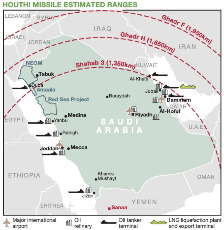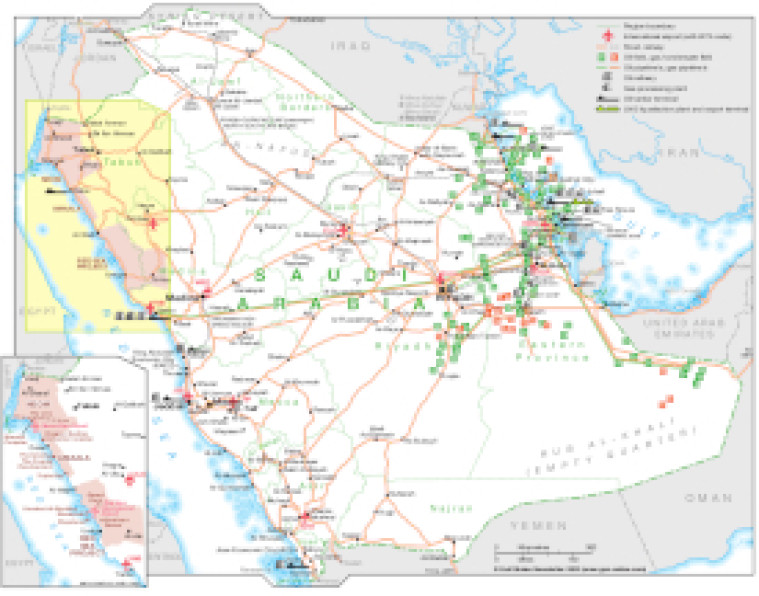
Revised January 2022, this map illustrates Saudi Arabia's major infrastructure. The main map shows the country's regional boundaries, major road and rail network and international airports (with their IATA codes).
The locations of onshore and offshore oil and gas/condensate fields and pipelines are marked alongside associated infrastructure including oil refineries, gas processing plants, tanker terminals and LNG facilities.
An inset provides greater detail of Neom, Amaala and the Red Sea Project.
The map is available as a PDF file using eps graphics, meaning that there is no loss of resolution as the file is enlarged.
Single GSN map
£495
(Single GSN map or graphic)
Subscribe to Gulf States Newsletter
Gulf States Newsletter is a brand of