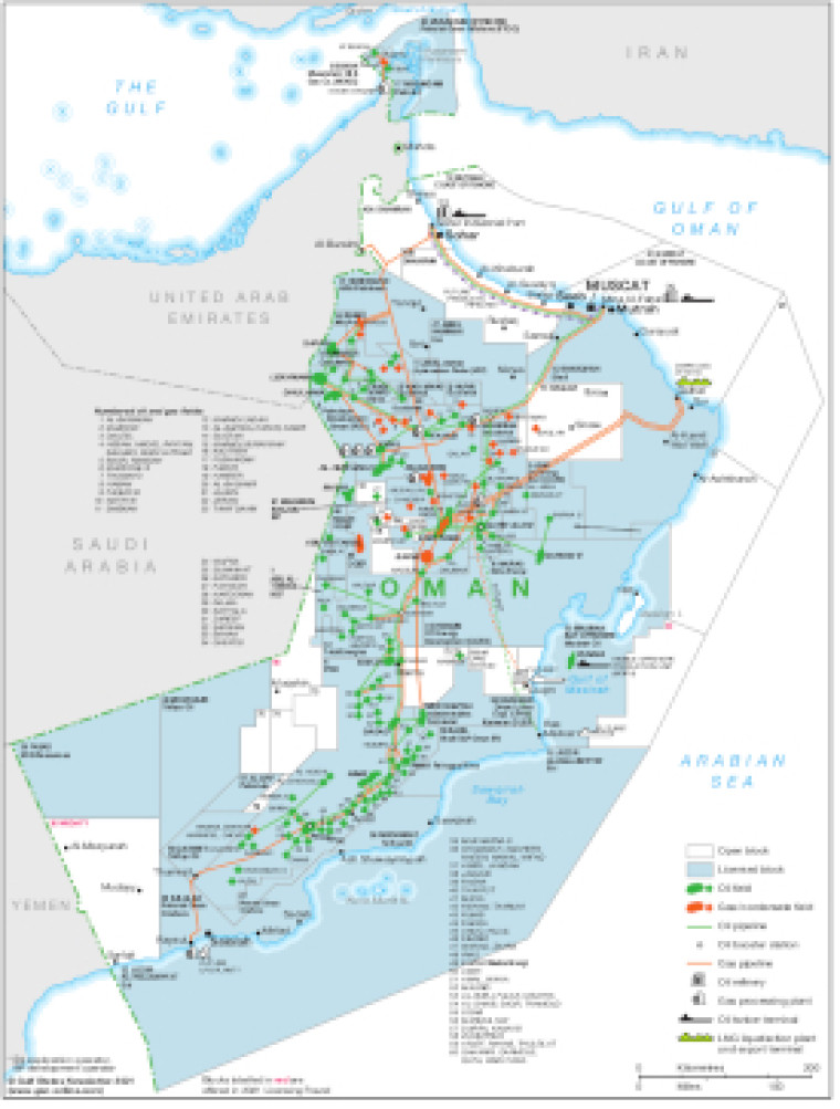
Updated in October 2021, this map provides a detailed overview of the hydrocarbons sector in Oman.
Open and licensed acreage is shown, with block operators and oil and gas fields marked, alongside associated downstream infrastructure such as pipelines, tanker terminals, refineries, gas processing plants and LNG facilities.
The map is available as a PDF file using eps graphics, meaning that there is no loss of resolution as the file is enlarged.
Single GSN map
£495
(Single GSN map or graphic)
Subscribe to Gulf States Newsletter
Gulf States Newsletter is a brand of