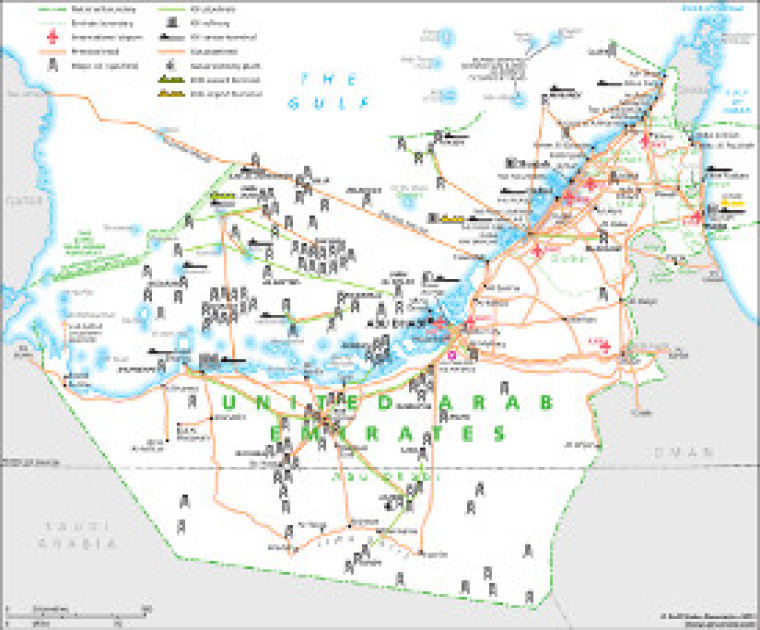
Revised in January 2013, this map provides an overview of infrastructure in the United Arab Emirates (UAE). Major roads and airports are shown alongside hydrocarbons infrastructure, such as oil and gas fields, pipelines, gas processing facilities, tanker terminals and refineries. The boundaries of the seven emirates (Abu Dhabi, Dubai, Fujairah, Ajman, Ras Al-Khaimah, Sharjah, and Umm Al-Quwain) are shown.
Single GSN map
£495
(Single GSN map or graphic)
Subscribe to Gulf States Newsletter
Gulf States Newsletter is a brand of