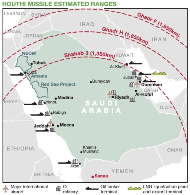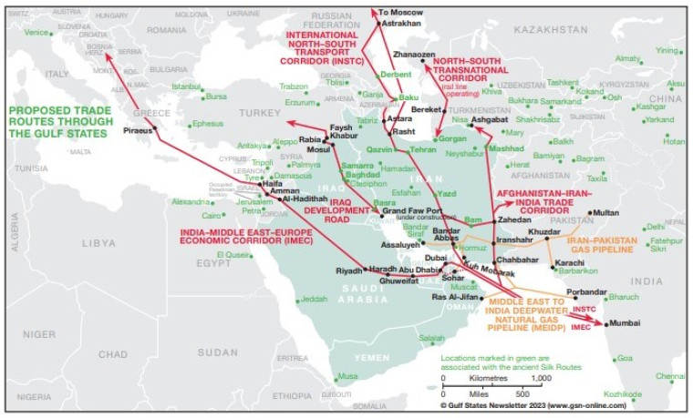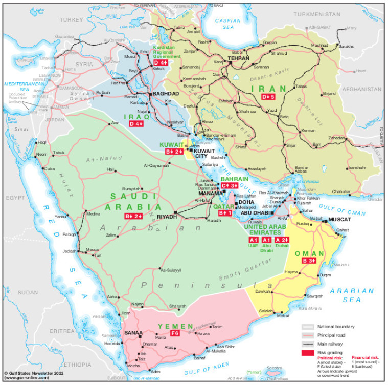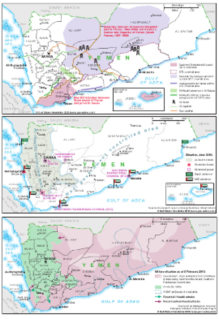
This graphic, includes three maps of the war in Yemen published in Gulf States Newsletter(GSN) between February 2018 and May 2020.
The maps show the shifting positions of forces over this period, with the latest map also showing oil producing areas and pipelines and the former boundary between the Yemen Arab Republic (North Yemen, 1962-1990) and People's Democratic Republic of Yemen (South Yemen, 1967-1990).
The file is available as a PDF using eps graphics, meaning that there is no loss of resolution as it is enlarged.
Single GSN map
£495
(Single GSN map or graphic)
Subscribe to Gulf States Newsletter
Gulf States Newsletter is a brand of