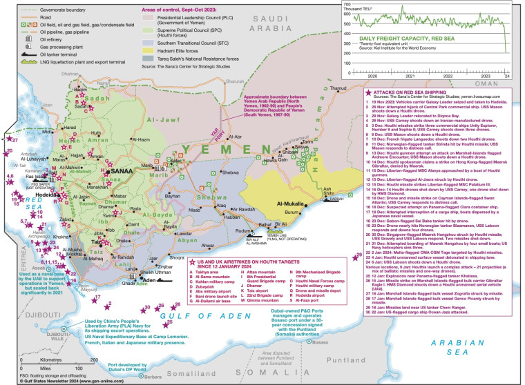
Revised January 2024, this map of Yemen illustrates the extent of Houthi attacks on Red Sea shipping between 19 November 2023 and 22 January 2024 as well as US and UK airstrikes on Houthi targets since 12 January 2024.
Attack sites and airstrikes are marked on the map, with a text panel providing a brief note on each incident.
The base Yemen map is shaded to show areas of control by each faction in the war (September/October 2023), with the main areas of conflict marked.
The map also shows the location of key infrastructure including roads, airports, oil, and gas fields, pipelines, refineries, oil tanker terminals and gas processing facilities.
Subscriber only content
An active subscription is required to view this article
Subscribe to Gulf States Newsletter
Gulf States Newsletter is a brand of